
Northamptonshire Maps
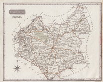
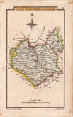
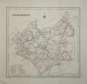
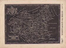
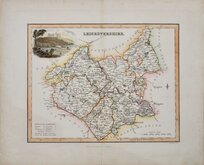
Leicestershire Maps
( Page 2 of 3 )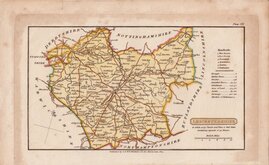
Henry Cooper 1808 [1825]
George Cole 1810 [1843]
Samuel John Neele 1818 [1819]
Sidney Hall 1820
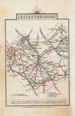
John Cary 1822
Roger Creighton 1831 [1844]
Joshua Archer 1833
Gray & Son. 1833 [1840]


24x19 cm
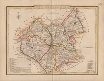
STEEL ENGRAVING WITH VIGNETTE OF BELVOIR CASTLE.
LEICESTERSHIRE.
Engd. by Gray & Son.
Pub.d by Archd. Fullarton & Co. Glasgow
Steel engraving by Gray & Son first published in Bell's New and Comprehensive Gazetteer in 1833. The text for the gazetteer was largely copied from Lewis' Topographical Dictionary of 1831 and in 1839 Lewis obtained an injunction against Bell for plagiarism and the work was withdrawn. Archibald Fullarton, the publisher of Bell's Gazetteer republished the maps with new text in The Parliamentary Gazetteer from 1840 until 1849. Most of the maps were also copied from those in an earlier topographical dictionary, the maps by Sidney Hall prepared for John Gorton's Topographical Dictionary of Great Britain and Ireland published in 1831 as a rival to Lewis' work.
Robert Gray (1771?-1848), Scottish engraver, lithographer and copperplate printer, trading from Glasgow as "Gray & Todd" between 1804 and 1806 and as "Gray & Son" from 1825 to 1848, initially with his son John, and later with his son James who continued the business after Robert Gray's death until at least 1856.
Very good hand coloured example of the map of Leicestershire with vignette of Belvoir Castle from the 1840 edition of The Parliamentary Gazetteer published by Archibald Fullarton & Co.
Quick Links


Staffordshire Maps

Warwickshire Maps
×