
Staffordshire Maps
Leicestershire Maps
( Page 2 of 3 )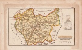
Henry Cooper 1808 [1825]
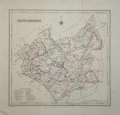
George Cole 1810 [1843]
Samuel John Neele 1818 [1819]
Sidney Hall 1820
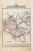
John Cary 1822
Roger Creighton 1831 [1844]
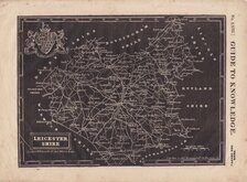
Joshua Archer 1833
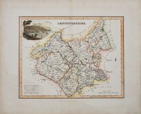
Gray & Son. 1833 [1840]


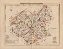
44x35 cm
CLEAR, UNCLUTTERED MAP. NEAT HAND COLOUR.
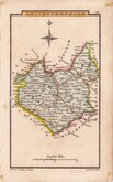
A New and correct Map of LEICESTERSHIRE & RUTLAND, Engraved from an actual Survey, with other Improvements.
London. Published by J. Harrison, No.115, Newgate Street, as the Act directs April 20. 1787.
This series of county maps were issued at erratic intervals over a four year period bearing dates between 1787 and 1789. The atlas Maps Of The English Counties… was first issued in 1791 by J. Harrison and remained on sale for several years but probably did not sell well as various price reductions are recorded. The author and engraver of this Leicestershire map are not given but other maps in the series were drawn by John Haywood and engraved by Sudlow.
The border is divided and numbered at 5' intervals with a graticule over the map.
A decorative and uncluttered map showing the roads and the hundred divisions. Good margins. Good later hand colour.
Quick Links


Warwickshire Maps

Northamptonshire Maps
×