
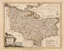
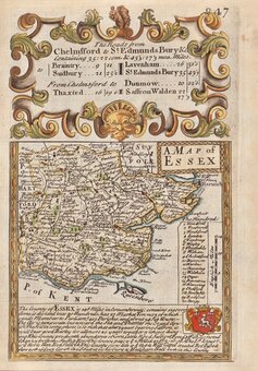
Essex Maps
Kent Maps
( Page 1 of 4 )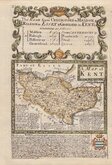
Emanuel Bowen 1720
Joseph Ellis 1773
Emanuel Bowen 1777
Eugene Henry Friex 1777

John Cary 1791
Benjamin Baker 1792
Robert Butters 1803
Charles Smith 1804


23x16 cm
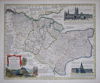
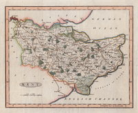
No. LXV.] GUIDE TO KNOWLEDGE. PRICE ONE PENNY.
KENT | London, Edwards, 12 Ave Maria Lane.
J.Archer sc. 100 Drummond Str. Euston Sq.
Woodblock engraved map by Joshua Archer. The woodblock was inked with a roller without working the ink into the engraved cuts thereby printing with a white line on a black ground. Published in parts by W. Edwards in The Guide to Knowledge edited by W Pinnock from 1833 The printing method was not popular for topographic maps and was not used again for English county maps. The woodblocks were later published by Thomas Johnson printed more conventionally by lithographic transfer in his rare publication Johnson's Atlas of England in 1847 & 1863.
Good example of the map of Kent from The Guide to Knowledge. (The title and price above is printed in the right margin outside the map.)
Quick Links
Sussex Maps
Surrey Maps
×