
Surrey Maps
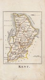
Kent Maps
( Page 1 of 3 )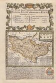
Emanuel Bowen 1720
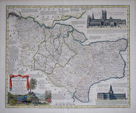
Emanuel Bowen 1763 [c.1777]
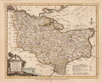
Joseph Ellis 1773
Eugene Henry Fricx 1777

John Cary 1789 [1791]
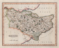
Benjamin Baker 1792
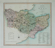
Charles Smith 1801 [1804]
Robert Butters 1803


23x19 cm
UNCOMMON FIRST ISSUE
KENT
Engraved by B.Baker Islington
This series were first published in The Universal Magazine of Knowledge and Pleasure by John Hinton from 1791 to 1797. They were then published in Maps of the several counties and shires in England by Darton and Harvey in 1804, and finally, with amendments in Laurie & Whittle's New and Improved English Atlas in 1807 and 1816.
This example is the first state and with two vertical folds, published in The Universal Magazine in 1792
Quick Links


Essex Maps

Sussex Maps
×