
Essex Maps
Kent Maps
( Page 1 of 3 )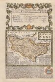
Emanuel Bowen 1720
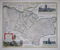
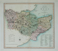
Emanuel Bowen 1763 [c.1777]
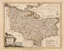
Joseph Ellis 1773
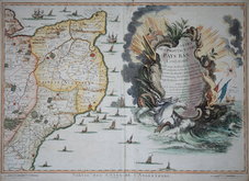
Eugene Henry Fricx 1777

John Cary 1789 [1791]
Benjamin Baker 1792
Charles Smith 1801 [1804]
Robert Butters 1803


50x41 cm
FROM THE ROYAL ENGLISH ATLAS. SCARCE.
An Accurate Map of the COUNTY of KENT Divided into its LATHES, and Subdivided into HUNDREDS, Drawn from the best Authorities and adorned with VIEWS of the Cathedral Churches of CANTERBURY & ROCHESTER, with descriptions of their respective Dioces &c. and other Improvements By Eman:Bowen Geogr. to His late MAJESTY.
London. Printed for Carington Bowles No.69, St Pauls Church Yard. John Bowles, No. 13, Cornhill. Robt. Sayer, & John Bennet, No. 53 Fleet Street. as the Act directs. 1st. of June 1777.
This series of maps, produced for The Royal English Atlas, were a reduction by two thirds of the maps from The Large English Atlas and were first published in 1763 only three years after the first complete issue of the Large English Atlas. There were a number of re-issues in the 1770's and 1780's with the final publication in 1828 by R. Martin but the publications were small and the work was not a commercial success, examples today being scarce.
This example of the map of Kent includes the dated imprint of 1777 which was published unchanged from 1779 until 1828.
There is an old repair to the bottom centrefold extending 5cm into the map. Light overall toning verso but It remains a very good strong impression of a scarce map. Original hand colour to the map with good later additions to decorative elements.
Quick Links


Sussex Maps

Surrey Maps
×