
Wiltshire Maps
Dorset Maps
( Page 1 of 3 )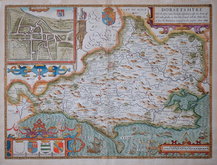
John Speed 1610 [1676]
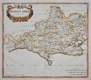
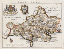
Robert Morden 1695
Robert Morden 1695
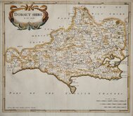
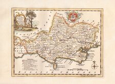
Owen & Bowen 1720
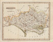
Robert Walker 1748
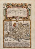
Thomas Kitchin 1750 [1786]
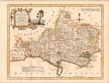
Thomas Kitchin 1764
Benjamin Baker 1791


22x17 cm
HOGG EDITION
An Accurate Map of DORSET SHIRE Drawn from the best Maps Charts &c. & Regulated by Astronl.Observns. By T.Kitchin Geog.r
First published in The London Magazine by R Baldwin from 1750, the maps were subsequently published in England Displayed by S Bladon etc., in 1769 and under various titles including Boswell's Antiquities by Alexander Hogg from 1786 to 1798.
Arms of Dorchester.
This good clean example on good paper is from a publication by Alexander Hogg in very good later hand colour.
Quick Links


Hampshire Maps

Somerset Maps
×