
Wiltshire Maps
Dorset Maps
( Page 1 of 3 )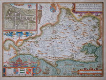
John Speed 1610 [1676]
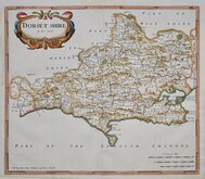
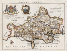
Robert Morden 1695
Robert Morden 1695
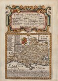
Owen & Bowen 1720
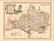
Robert Walker 1748
Thomas Kitchin 1750 [1786]
Thomas Kitchin 1764
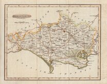
Benjamin Baker 1791


12x18 cm
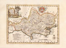
FROM "OWEN & BOWEN" ROAD BOOK
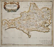
DORSET SHIRE
Map set below a decorative cartouche containing the title and details of the road from Bristol to Weymouth.
Road map of the final part of the raod from Bristol to Gloucester verso.
Engraved text description of the county below the county map.
Engraved by Emanuel Bowen (1693?-1767) and published in the pocket road book Britannia Depicta by Thomas Bowles from 1720 to 1764. The county maps were based on Robert Morden's small series published in The New Description and State of England... from 1701. Text descriptions were compiled by John Owen.
Very good example in neat later hand colour.
For full description of the road, go to category Owen & Bowen under Road Maps.
For information on the publication Britannia Depicta see the description below the category heading Owen & Bowen under Road Maps.
Quick Links


Hampshire Maps

Somerset Maps
×