
Staffordshire Maps
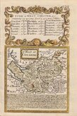
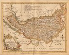
Cheshire Maps
( Page 1 of 3 )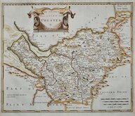
Robert Morden 1695
Emanuel Bowen 1720
Joseph Ellis 1765 [1773]
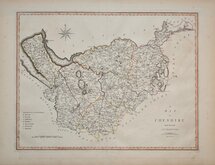
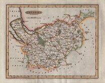
John Cary 1789 [1805]
Benjamin Baker 1791
Robert Butters 1803
Charles Smith 1804
Henry Cooper 1808


52x40 cm
"CARY STOCKDALE"
A MAP of CHESHIRE from the best AUTHORITIES.
Published by John Stockdale Piccadilly 26th. March 1805.
Engraved by J. Cary.
Copper engraving by John Cary (1755-1835). The maps were first issued in parts by T. Payne & Son, and G.G.J. & J. Robinson for Richard Gough's translation of William Camden's Britannia, the completed work being published in 1789. Following the death of Payne, the Robinson family sold the plates and publication rights to John Stockdale. Richard Gough was reportedly annoyed with the new arrangements and refused to work on the new edition and Stockdale completed the editorial work himself, expanding the work to four folio volumes and publishing them in 1806. Stockdale also used the plates in his New British Atlas from 1805 to 1809.
Good example in original hand colour from Stockdale's New British Atlas of 1805.
SPECIAL OFFER MOUNT AVAILABLE AT CHECKOUT FOR UK DELIVERY.
Quick Links


Lancashire Maps

Road Maps
×