
Lancashire Maps
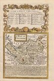
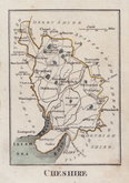
Cheshire Maps
( Page 1 of 3 )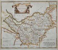
Robert Morden 1695
Emanuel Bowen 1720
Joseph Ellis 1765 [1773]
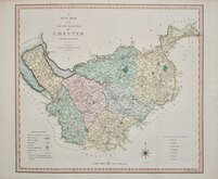
John Cary 1789 [1805]
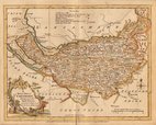
Benjamin Baker 1791
Robert Butters 1803
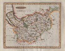
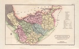
Charles Smith 1804
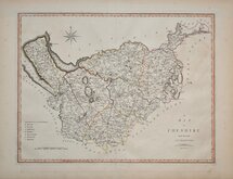
Henry Cooper 1808


51x45 cm
FINE FOLIO MAP IN ORIGINAL COLOUR.
A NEW MAP of the COUNTY PALATINE of CHESTER Divided into Hundreds.
LONDON Printed for C. SMITH No. 172 Strand. January 6th. 1804.
Engraved by the firm of Jones and Smith, this series of large county maps were produced for Smith's New English Atlas being a complete set of County Maps, Divided into Hundreds...first published by C. Smith, London 1804. The maps were also issued separately from 1801.
Charles Smith (1768?-1854), was a publisher, stationer and map-seller working from The Strand 1800-1854, he was appointed Map-seller to the Prince of Wales by 1809 and trading as “Charles Smith & Son” or “Smith & Son” 1826-1854, Charles himself retiring in 1852. The business continued in the family until 1916 when it was taken over by the firm of George Philip.
The publication of this work predated the publication of Cary's New English Atlas, a work of striking similarity, by five years, and was the first series of county maps to show longitude measured from the Greenwich meridian.
Charles Smith was not related to the engraving firm of “Jones and Smith” or “Smith and Jones” formed by the partnership of engravers Edward Jones (fl.1799-1818) and Charles Smith (1768?-1854) trading 1799-1801 and with Joseph Bye (1779-1817) as “Jones, Smith & Bye” or Jones, Smith & Co. 1801-1804.
A very good example of this large folio map from the first atlas edition of 1804 in full original hand colour.
SPECIAL OFFER MOUNT AVAILABLE AT CHECKOUT FOR UK DELIVERY
Quick Links


Road Maps

Staffordshire Maps
×