
Lancashire Maps
Cheshire Maps
( Page 1 of 3 )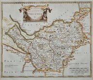
Robert Morden 1695
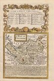
Emanuel Bowen 1720
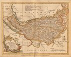
Joseph Ellis 1765 [1773]
John Cary 1789 [1805]
Benjamin Baker 1791
Robert Butters 1803
Charles Smith 1804
Henry Cooper 1808


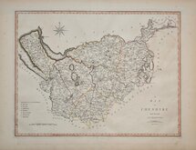
12x7 cm
COLOURFUL MINIATURE MAP
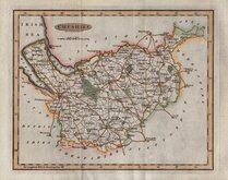
CHESHIRE
Pub. by S.Leigh 18.Strand. | Sidy.Hall sculpt.
Miniature map engraved by Sidney Hall and first published in Leigh's New Pocket Atlas of England and Wales in 1820. The little atlas was popular running to ten editions until the final editions in 1842 & 3 published by George Biggs.
Fine hand coloured example from the first edition.
Quick Links


Staffordshire Maps

Road Maps
×