
Staffordshire Maps
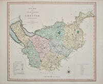
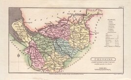
Cheshire Maps
( Page 1 of 3 )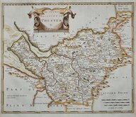
Robert Morden 1695
Emanuel Bowen 1720
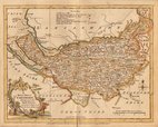
Joseph Ellis 1765 [1773]
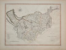
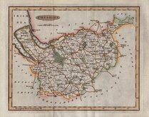
John Cary 1789 [1805]
Benjamin Baker 1791
Robert Butters 1803
Charles Smith 1804
Henry Cooper 1808


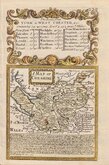
15x9 cm
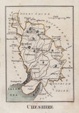
CARY'S MINIATURE SERIES.
CHESHIRE
London. Published by G.& J. Cary, No.86 St.James's Str.
A re-engraved and revised version of of the map issued by John Cary in 1806 which in turn, was a re-engraved version of his 1789 map. All were issued under the title of Cary's Traveller's Companion, a highly successful work necessitating the re-engraving of worn plates to continue publication. This version was published with his brother, George, between 1822 and 1828 and was the only version with place names on the map engraved to read with North at the top, the title, imprint and distances from London being engraved sideways.
Good example in original hand colour with generous margins.
Quick Links


Road Maps

Lancashire Maps
×