
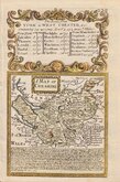
Staffordshire Maps
Cheshire Maps
( Page 1 of 3 )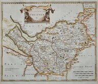
Robert Morden 1695
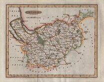
Emanuel Bowen 1720
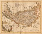
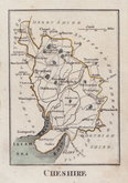
Joseph Ellis 1765 [1773]
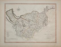
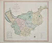
John Cary 1789 [1805]
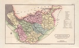
Benjamin Baker 1791
Robert Butters 1803
Charles Smith 1804
Henry Cooper 1808


25x20 cm
FINE ENGRAVING. PASTORAL TITLE CARTOUCHE.
A Modern MAP of CHESHIRE, Drawn from the latest Surveys: Corrected & Improved by the best Authorities.
Printed for Carington Bowles in St. Pauls Church yard & Robt. Sayer in Fleet Street.
First published in The New English Atlas… in 1765, the atlas became a considerable success with many editions, under the title Ellis's English Atlas, being published over a period of thirty years from the offices of Robert Sayer and Carington Bowles. Its popularity was due to it's cartographical clarity while being of pocket size making it useful for the traveller as well as everyday use in academies and the home. Most of the maps were copied from those by Thomas Kitchin in a rival publication of similar pocket size by Robert Dodsley England Illustrated first published in 1763 but which, without the commercial abilities of Sayer and Bowles, did not achieve the same success.
This example is from the 1773 edition of Ellis's English Atlas.
Quick Links

Road Maps

Lancashire Maps
×