
Folding Maps
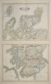
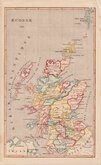
Whole of Scotland
( Page 1 of 2 )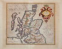
Gerard Mercator 1607
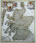
Johann Baptist Homann 1710
Matthaus Seutter 1735
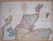
John Cary 1805
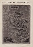
William Pinnock 1834
William Home Lizars 1841
Firmin-Didot 1843
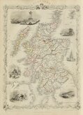
John Rapkin 1851


26x36 cm
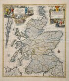
SCOTLAND.
Drawn and engraved on steel by John Rapkin, this series of finely engraved maps were first published in parts from the end of the 1840's and issued as a complete volume, The Illustrated Atlas in 1851. The work was re-issued a number of times until about 1865 and the maps were then used by Montgomery Martin, the author of the text in the Illustrated Atlas, in his British Colonies from 1854. The final appearance of the maps, with vignettes erased from the plate, was in geographical dictionaries and encyclopaedias until about 1880.
Vignettes of Edinburgh, Deer Stalking, Shinty, Brig of Doon, Scott's Monument and Holyrood House with inset plan of The Shetland Isles.
Slight scuff to paper at Scott's Monument vignette but a good example with good margins from the Illustrated Atlas of 1851 in original outline colour, without centrefold and including separate page of typeset text description of Scotland.
Quick Links


Parts of Scotland
British Islands
×