
British Islands
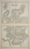
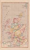
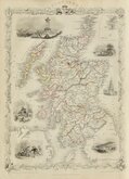
Whole of Scotland
( Page 1 of 2 )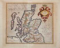
Gerard Mercator 1607
Johann Baptist Homann 1710
Matthaus Seutter 1735
John Cary 1805
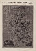
William Pinnock 1834
William Home Lizars 1841
Firmin-Didot 1843
John Rapkin 1851


48x58 cm
MAGNAE BRITANNIAE | Pars Septentrionalis | qua | REGNUM SCOTIAE | in suas Partes et subjacentes Insulas divisum | ACCURATA TABULA | ex archetypo VISHERIANO desumpta exhibetur | imitatore | IOHAN BAPT. HOMANNO | Noribergae
Copper engraving by Johan Baptist Homman (1663-1724) first pubished in Atlas Novus c.1710 and by Homann's heirs in Grosser Atlas uber die gantze Welt 1731, Atlas Geographicus Major 1759, Bequemer Hand Atlas 1754-90.As stated in the title, the map is based on Nicolaus Visscher's map of c.1689. It was the only map of Scotland produced by Homann.
Split and creasing at left centrefold repaired with archival taape verso but still a good example with original colour to the map and later hand colouring to the cartouches.
Quick Links

Folding Maps

Parts of Scotland
×