
Folding Maps
Whole of Scotland
( Page 1 of 2 )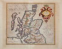
Gerard Mercator 1607
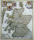
Johann Baptist Homann 1710
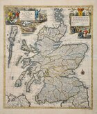
Matthaus Seutter 1735
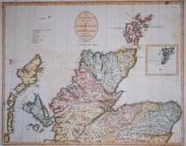
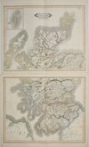
John Cary 1805
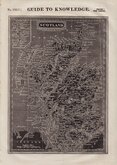
William Pinnock 1834
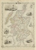
William Home Lizars 1841
Firmin-Didot 1843
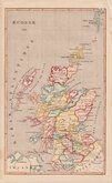
John Rapkin 1851


53x82 cm
Two maps;
A | New & Correct | MAP | of the | NORTH PART | of | SCOTLAND | from the best | AUTHORITIES | Engraved by J. Cary.
A | New & Correct | MAP | of the | SOUTH PART | of | SCOTLAND | from the best | AUTHORITIES. | Engraved by J. Cary.
Pair of copper engraved maps by John Cary first published in Richard Gough's translation of William Camden's Britannia in 1789. The maps also appeared in the 1806 edition of the same work and in Cary's New British Atlas published by John Stockdale in 1805.
From the 1805 Stockdale edition. Some off-setting, mostly on South sheet and small but complete margins. Still a good hand coloured matching pair of maps.
Each map measures: 52x39cm South sheet and 53x43 North sheet.
Quick Links


Parts of Scotland
British Islands
×