
Road Maps
Waterways & Railways
( Page 1 of 2 )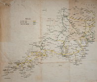
Railways Anonymous 1950
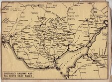
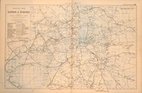
Southall's Railway Map South Wales 1900
John Roper 1809
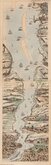
Thames London Ramsgate 1830
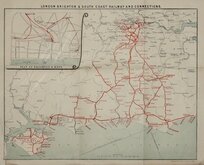
London Brighton Railway 1910
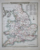
G W Bacon 1900
James Baker Thames 1802
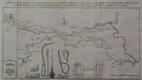
Canal, Leeds to Selby 1774


£15 Southall's Railway Map South Wales
Ref: 7620g
Add to
basket
Thanks,Your Product Has Been Added To Basket

23x17 cm
SOUTHALL'S RAILWAY MAP FOR SOUTH EAST WALES
SOUTHALL PRINTER, NEWPORT
Lithograph printed map on yellow paper showing the railways from Bristol to Newport, Cardiff, Swansea, Brecon, Merthyr and Monmouth.
John Edward Southall (1855-1928) was a Quaker printer, publisher and author established in Newport from 1879 until about 1930 specialising in school textbooks, the Quakers, and the Welsh language.
Trimmed to border and tipped to paper. Another unidentified but similar map of the railways of North Wales is tipped onto the paper verso, also trimmed to border but with loss to bottom centre and left margin.
Quick Links


London Maps

Town Plans
×