
Leicestershire Maps
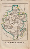
Warwickshire Maps
( Page 1 of 3 )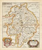
Richard Blome 1673
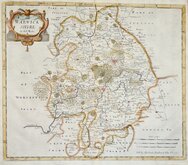
Robert Morden 1695
Emanuel Bowen 1720
Emanuel & Thomas Bowen 1767 [c.1770]
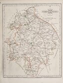
John Cary 1787 [c.1793]
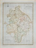
John Haywood 1788
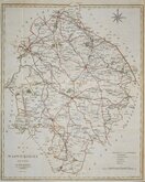
Edward Noble 1789 [c.1805]
Robert Butters 1803


12x18 cm
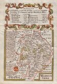
FROM "OWEN & BOWEN" POCKET ROAD BOOK BRITANNIA DEPICTA.
WARWICKSHIRE
Map set below a decorative cartouche containing the title and details of the road from Oxford to Coventry and Derby.
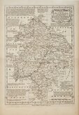
Road map of the second part of the route from Oxford to Chichester verso.
Engraved text descriptions alonside the county map and below the road map.
Engraved by Emanuel Bowen (1693?-1767) and published in the pocket road book Britannia Depicta by Thomas Bowles from 1720 to 1764. The county maps were based on Robert Morden's small series published in The New Description and State of England... from 1701. Text descriptions compiled by John Owen.
Slight water damage to page edges otherwise good.
For full description of the road, go to category: Maps > British Isles > RoadMaps > Owen & Bowen. For more information on Britannia Depicta, see the category heading under Road Maps > Owen & Bowen.
Quick Links


Staffordshire Maps

Worcestershire Maps
×