
Worcestershire Maps
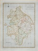
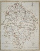
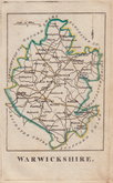
Warwickshire Maps
( Page 1 of 3 )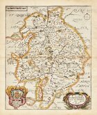
Richard Blome 1673
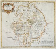
Robert Morden 1695
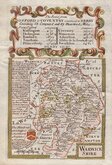
Emanuel Bowen 1720
Emanuel & Thomas Bowen 1767 [c.1770]
John Cary 1787 [c.1793]
John Haywood 1788
Edward Noble 1789 [c.1805]
Robert Butters 1803


31x44 cm
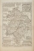
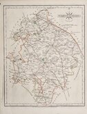
WEEKLY DISPATCH SERIES CASSELL EDITION
WARWICKSHIRE.
(Weekly Dispatch ... incompletely erased)
LONDON, PUBLISHED BY CASSELL, PETTER & GALPIN, LA BELLE SAUVAGE YARD, LUDGATE HILL, E.C.
This series of maps were printed by lithographic transfer from engraved plates by Edward Weller, John Dower and Benjamin Rees Davies. The plates were never used for direct intaglio printing. The first publication was in the Weekly Dispatch Newspaper between 1856 and 1862, followed by loose sheet issues and, when the series was complete, in The Dispatch Atlas in 1863. The publishers Cassell Petter and Galpin acquired the plates and published them in Cassell's Illustrated family paper and Cassell's British Atlas in 1867, By 1869, the firm of G. W. Bacon had acquired the plates and published them in a number of titles for over forty years.
Fine hand coloured example from the 2nd lithographic transfer published by Cassell in his British Atlas 1867.
Harvey & Thorpe Printed Maps of Warwickshire ref. 109 B.
Quick Links


Leicestershire Maps

Staffordshire Maps
×