
Road Maps
Town Plans
( Page 3 of 13 )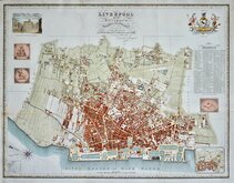
Liverpool 1824
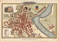
Lancaster 1824
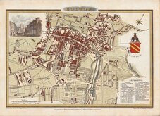
Bolton 1824
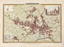
Blackburn 1824
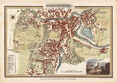
Stockport 1824
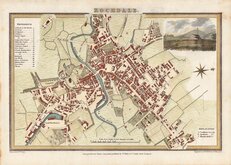
Rochdale 1824
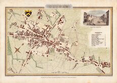
Oldham 1824
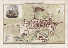
Ashton under Lyne 1824


54x42 cm
LIVERPOOL | and its | ENVIRONS. | Engraved from an actual Survey made by | WILLIAM SWIRE | in 1823, and 1824 for | The HISTORY, DIRECTORY & GAZETTEER of LANCASHIRE. | Published by Willm,, Wales & Co,, | Castle Street Liverpool.
Neele & Son, sc. 352 Strand.
Finely engraved plan by Neele and Son from a survey by William Swire flanked by a vignette of the Town Hall and Exchange Buildings, The Arms, motto, crest and supporters (Neptune and a Merman) of Liverpool, Seals of the Trustees of Liverpool Docks, The Corporation of the Liverpool Exchange, and The Corporation of Liverpool, and an inset Plan of Liverpool in 1720.
Published in The History, Directory and Gazetteer of the County Palatine of Lancaster by Edward Baines 1824-5.
The plan has several folds as usual with archival tape strengthening at edges and a repair to the left margin not affecting the printed area. No tears or damage.
A fine large detailed and decorative plan in fine later hand colour.
Quick Links

Waterways & Railways

London Maps
×