
Middlesex Maps
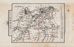
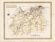
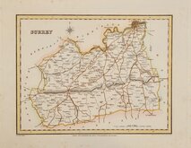
Surrey Maps
( Page 3 of 5 )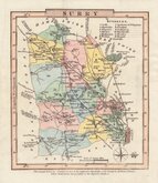
Charles Cooke 1806
John Cary 1808
Cole & Roper 1810
Samuel John Neele 1818
Sidney Hall 1820
John Cary 1822
John Heywood 1830 [1868]
Roger Creighton 1831


11x13 cm
FIRST STATE.
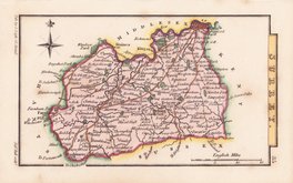
SURRY
Note below the map reads: The County Town is denoted by red & the respective Hundreds of the County by different Colours. which distinctions are peculiar to the Superior Edition.
North is to the right.
Copper engraving first published in parts, county by county, in A Topographical and statistical description of the county of…by George Alexander Cooke…Illustrated with a map of the county. London, C. Cooke [1806].
Further publications by Cooke followed under titles; The Modern British Traveller… & Topography of Great Britain… in 1810 & 1822. The maps were next issued, with plate numbers added, in Gray’s New Book of the Roads…by George Carrington Gray London, Sherwood, Jones and Co., 1824. Their final appearance was a republication of the first issue, London, Sherwood, Gilbert and Piper, “printed by assignment from the executors of the late C. Cooke”.
This hand coloured example of the map of Surrey is the first state of the plate, without plate number top right, issued between 1806 and 1822.
SPECIAL OFFER MOUNT OPTION AVAILABLE ON THIS ITEM AT CHECKOUT FOR UK CUSTOMERS.
Quick Links


Sussex Maps

Kent Maps
×