
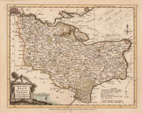
Surrey Maps
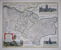
Kent Maps
( Page 1 of 3 )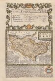
Emanuel Bowen 1720
Emanuel Bowen 1763 [c.1777]
Joseph Ellis 1773
Eugene Henry Fricx 1777

John Cary 1789 [1791]
Benjamin Baker 1792
Charles Smith 1801 [1804]
Robert Butters 1803


24x19 cm
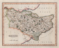
EARLY STEEL ENGRAVING WITH VIGNETTE OF CANTERBURY CATHEDRAL.
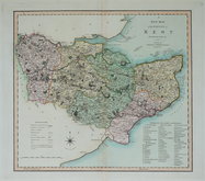
KENT
Pubd. by Archd. Fullarton & Co. Glasgow.
Steel engraving by Robert Scott first published in Bell's New and Comprehensive Gazetteer in 1833. The text for the gazetteer was largely copied from Lewis' Topographical Dictionary of 1831 and in 1839 Lewis obtained an injunction against Bell for plagiarism and the work was withdrawn. Archibald Fullarton, the publisher ofBell's Gazetteer republished the maps with new text in The Parliamentary Gazetteer from 1840 until 1849. The engraving work was shared between Gray & Son, James Neele and Robert Scott with most maps copied from those by Sidney Hall in an earlier topographical dictionary, John Gorton'sTopographical Dictionary of Great Britain and Ireland published in 1831.
This map of Kent is unsigned but bears the compass rose used by Robert Scott.
Vignette of Canterbury Cathedral and St. Augustines' Gate.
Good hand coloured example.
Quick Links


Essex Maps

Sussex Maps
×