
Wiltshire Maps
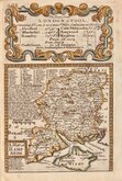
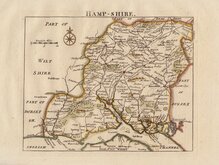
Hampshire Maps
( Page 1 of 3 )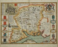
John Speed 1611
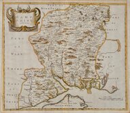
Robert Morden 1695
Emanuel Bowen 1720
Thomas Read 1769
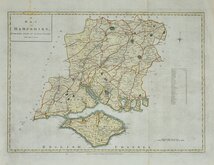
John Haywood 1791
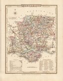
Cole & Roper 1810
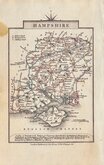
George & John Cary 1822
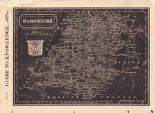
Sidney Hall 1833


24X20 cm
HAMPSHIRE, | OR | SOUTHAMPTON.
Pub.d by Arch.d Fullarton & C.o
Steel engraving by Gray & Son first published in Bell's New and Comprehensive Gazetteer in 1833. The text for the gazetteer was largely copied from Lewis' Topographical Dictionary of 1831 and in 1839 Lewis obtained an injunction against Bell for plagiarism and the work was withdrawn. Archibald Fullarton, the publisher of Bell's Gazetteer republished the maps with new text in The Parliamentary Gazetteer from 1840 until 1849. Most of the maps were also copied from those in an earlier topographical dictionary, the maps by Sidney Hall prepared for John Gorton's Topographical Dictionary of Great Britain and Ireland published in 1831 as a rival to Lewis' work.
Includes a vignette of Alnwick Castle.
Robert Gray (1771?-1848), Scottish engraver, lithographer and copperplate printer trading from Glasgow as "Gray & Todd" 1804-18056 and as "Gray & Son" 1825-1848, initially with his son John, and later with his son James who continued the business after Robert Gray's death until at least 1856.
Some spotting mainly to margins. Fine hand colour.
Quick Links
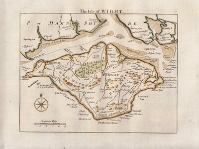
Isle of Wight

Berkshire Maps
×