
Wiltshire Maps
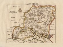
Hampshire Maps
( Page 1 of 3 )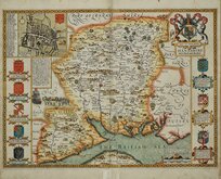
John Speed 1611
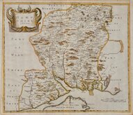
Robert Morden 1695
Emanuel Bowen 1720
Thomas Read 1744 [1769]
John Haywood 1791
George Cole 1810
Sidney Hall 1820 [1834]
George & John Cary 1822


42x37 cm
FIRST MAP TO SHOW LONGITUDE FROM LONDON AND LOCAL TIME
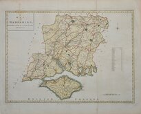
HAMP SHIRE by Rob.t Morden.
Copper engraving produced by Robert Morden for publication in Edmund Gibson's translation of William Camden's Britannia first published by Abel Swalle and Awnsham & John Churchill in 1695.
This is the first series of maps to mark longitude in minutes of time (top border) as well as in degrees (bottom border). For most counties longitude is based on the meridian of St. Paul's, London.
The work was republished in 1722, 1730, 1753 and, finally in 1772. The plate was updated for the 1722 edition mostly with changes to place name spellings and was reworked for the 1753 edition due to wear on the plate.
Good hand coloured example from the first edition of 1695. Small side margins re-margined left and right in matching rag paper. Slight loss to top left printed border line.
Quick Links


Berkshire Maps
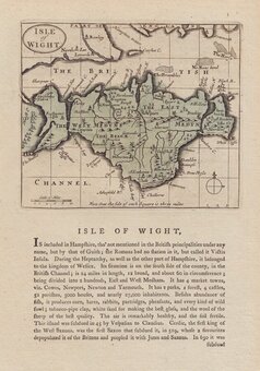
Isle of Wight
×