
Somerset Maps
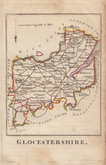
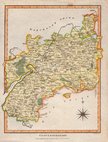
Gloucestershire Maps
( Page 1 of 3 )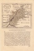
John Seller 1693 [c.1784]
Robert Morden 1695
Emanuel Bowen 1720
Thomas Kitchin 1751 [c.1786]
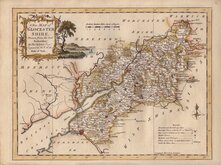
Thomas Kitchin 1763
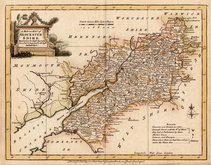
Joseph Ellis 1765 [1773]
Robert Butters 1803
Neele Samuel 1805


20x26 cm
UNCOMMON
GLOCESTERSHIRE.
Neele sculp. Strand.
London. Published as the Act directs. August 10th 1805 by J.Wilkes.
Copper engraving by Samuel John Neele based on John Cary's 'quarto' map from his New and Correct English Atlas of 1787. This series were published in Encyclopaedia Londinensis.. by John Wilkes from 1810 and 1829, culminating in 24 volumes. Wilkes was fined for plagiarism for the text of the work. The maps appeared in no other publication and are uncommon today.
Samuel John Neele (1758-1824) was a prolific engraver working from Russell Court from 1781 and 352 Strand from 1785-1824. He traded with his younger brother George Neele as “S.& G. Neele” 1826-1824 and with his son James Neele as “Neele & Son” 1816-1824.
Good hand coloured example.
Quick Links


Wiltshire Maps
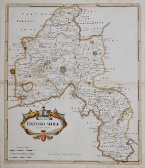
Oxfordshire Maps
×