
Oxfordshire Maps
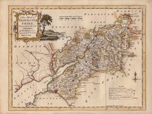
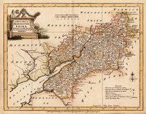
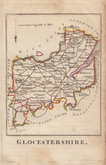
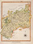
Gloucestershire Maps
( Page 1 of 3 )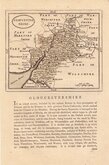
John Seller 1693 [c.1784]
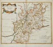
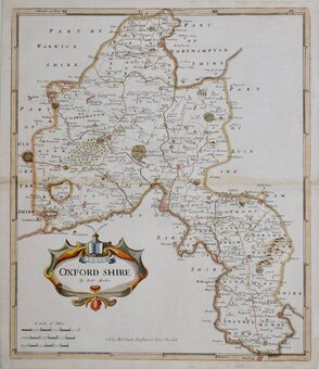
Robert Morden 1695
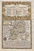
Emanuel Bowen 1720
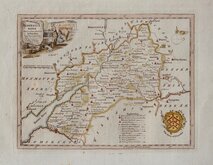
Thomas Kitchin 1751 [c.1786]
Thomas Kitchin 1763
Joseph Ellis 1765 [1773]
Robert Butters 1803
Neele Samuel 1805


17x25 cm
WOOD ENGRAVED MAP
No.XXXVIII.] GUIDE TO KNOWLEDGE PRICE ONE PENNY.
GLOCESTERSHIRE | London, W. Edwards, 12 Ave Maria Lane.
J. Archer sc.
Woodblock engraved map by Joshua Archer. The woodblock was inked with a roller without working the ink into the engraved cuts thereby printing with a white line on a black ground. Published by W. Edwards in The Guide to Knowledge edited by W Pinnock in 1833. The maps in this format were issued in this single publication and the printing method was not popular for topographic maps and was not used again for English county maps. The woodblocks were later published by Thomas Johnson printed more conventionally by lithographic transfer in his rare publication Johnson's Atlas of England in 1847 & 1863.
Closed tear left margin extending into map just above Bristol repaired with archival tape verso. Some printing ink over the top title outside the map.
Quick Links

Wiltshire Maps

Somerset Maps
×