
Essex Prints
Essex Maps
( Page 1 of 5 )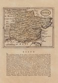
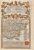
John Seller 1694 [1784]
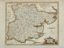
Emanuel Bowen 1720
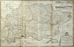
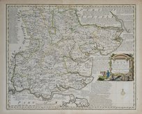
Warburton Bland & Smyth 1726
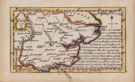
Thomas Read 1746 [1769]
Thomas Kitchin 1748 [1786]
Emanuel Bowen 1749
John Gibson 1759
Emanuel Bowen 1763


25x19 cm
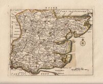
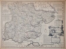
RAILWAYS UPDATED TO C.1852
ESSEX | ENGRAVED BY SIDY. HALL
London, Published by Chapman & Hall, 193 Piccadilly.
This series of maps first appeared in Gorton's Topographical Dictionary ssued in parts over a three year period from 1830, the complete work not published again after 1833. The maps were then issued in A New British Atlas…, Sidney Hall's British Atlas…, A Travelling County Atlas… and other variations on the title, from 1834 until c.1888. It's popularity due in part to Hall's continuous updating of the plates to include the latest railways. The maps were intaglio printed until c.1858 and then by lithographic transfer.
This intaglio printed example, with Chapman & Hall’s changed address to Piccadilly, was published from 1852 to 1857. Original outline hand colour. Archival tape repairs to centrefold splits into border verso.
Quick Links

Road Maps

Hertfordshire Maps
×