
Road Maps
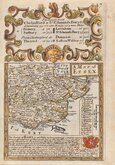
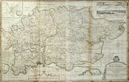
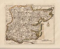
Essex Maps
( Page 1 of 5 )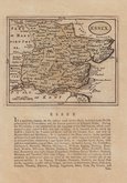
John Seller 1694 [1784]
Emanuel Bowen 1720
Warburton Bland & Smyth 1726
Thomas Read 1746 [1769]
Thomas Kitchin 1748 [1786]
Emanuel Bowen 1749
John Gibson 1759
Emanuel Bowen 1763


71x53 cm
LARGE ENGLISH EARLY HINTON IMPRINT
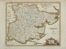
An ACCURATE MAP of the COUNTY of ESSEX, Divided into its HUNDREDS; Drawn from late SURVEYS and Illustrated with various additional Improvements:- ALSO Historical Extracts relating to its Trade, Manufactures, Natural History &c. not Extant in any other Map of this County By Eman: Bowen GEOG:R to HIS MAJESTY.
Sold by John Hinton at the Kings Arms in S.t Pauls Church Yard London.
Copper engraving by Emanuel Bowen first issued in parts from 1749 and published in The Large English Atlas from 1760. The work was the first large scale atlas of English counties since the works of Blaeu and Jansson a century earlier and was based on the latest surveys available (most maps at this time were still based on those of Speed and Saxton, their plates being still in use). The maps were a long time in preparation, beginning in 1749 with the county of Sussex and reaching completion of 45 plates in 1760. The engraving work was mostly shared between Thomas Kitchin and Emanuel Bowen. During this time the plates passed through the hands of several publishers and were issued individually and in part works without title. The Large English Atlas was issued by various publishers until c.1794 with very few changes to the maps.
This map of Essex, with the imprint of John Hinton, is from the pre-atlas issue published in parts from May 1749. Hinton intended to publish the maps at monthly intervals but after the first five, Sussex (24 May), Norfolk (14 June), Huntingdonshire (12 July), Hertfordshire (17 August) and Essex (29 September), the regular issues faltered and the next maps did not appear until March 1750, other maps appearing at erratic interval thereafter.
A good early example from the rare parts issue of 1749 by John Hinton in original outline hand colour.
The map is toned overall but the paper remains strong. There are a few repaired nicks to the paper edges outside the plate mark. Closed tear at lower centrefold reaching the engraved border. Margins are approx.20mm, all round.
Quick Links

Essex Prints

Hertfordshire Maps
×