
Essex Prints
Essex Maps
( Page 1 of 5 )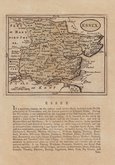
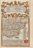
John Seller 1694 [1784]
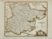
Emanuel Bowen 1720
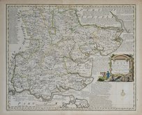
Warburton Bland & Smyth 1726
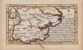
Thomas Read 1746 [1769]
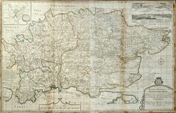
Thomas Kitchin 1748 [1786]
Emanuel Bowen 1749
John Gibson 1759
Emanuel Bowen 1763


23x18 cm
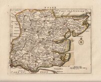
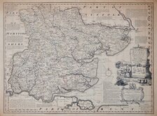
DIVISIONS OF THE POOR LAW UNIONS
ESSEX
Drawn by R.Creighton. | ENGRAVED BY T.Starling.London.
DRAWN AND ENGRAVED FOR LEWIS' TOPOGRAPHICAL DICTIONARY.
Copper engraving by Thomas Starling from a drawing by Roger Creighton issued in A Topographical dictionary of England… published by Samuel Lewis and Co. from 1831. The work achieved considerable success and was re-issued many times by Lewis until 1849. During this time the maps were amended and updated to include electoral information and the rapidly expanding railway network, with most counties known in at least six different states.
Good clean example with the addition of the poor-law unions outlined in original hand colour issued in 1845.
Quick Links

Road Maps

Hertfordshire Maps
×