
Essex Prints
Essex Maps
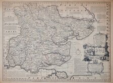
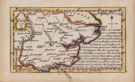
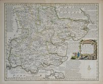
( Page 1 of 5 )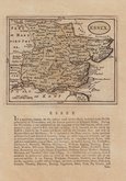
John Seller 1694 [1784]
Emanuel Bowen 1720
Warburton Bland & Smyth 1726
Thomas Read 1746 [1769]
Thomas Kitchin 1748 [1786]
Emanuel Bowen 1749
John Gibson 1759
Emanuel Bowen 1763


24x18 cm
ORIGINAL WASH HAND COLOUR.
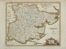
ESSEX
Drawn & Engraved by J.Archer, Pentonville, London.
First published in Curiosities of Great Britain, England and Wales Delineated…by Thomas Dugdale by L.Tallis in 1842. The work was re-issued a number of times until 1860. The maps also appeared in The Universal English Dictionary…by the Rev. James Barclay and finally in Tallis's topographical dictionary of England & Wales in 1860.
Joshua Archer (c.1792-1863) Engraver, cartographer and copperplate printer, was born in Barnstaple in Devon. His first recorded work as an engraver was a map of Scotland for Robert Wilkinson in 1814. He was declared bankrupt in 1835, imprisoned for debt in 1845, but on the 1861 census, he is recorded as a map and chart engraver aged 69, living in Islington with his wife Jane, a son, John, also a map and chart engraver, Albert Archer, map and chart draughtsman, Albert’s wife Elizabeth and their three children. His death was recorded at Islington in the final quarter of 1763.
This example is from the 1858 edition of Dugdales Curiosities in original wash hand colour.
Quick Links

Road Maps

Hertfordshire Maps
×