
Hertfordshire Maps
Essex Maps
( Page 1 of 5 )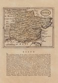
John Seller 1694 [1784]
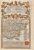
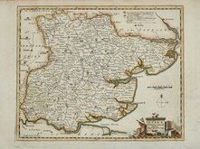
Emanuel Bowen 1720
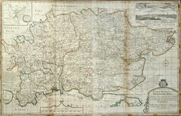
Warburton Bland & Smyth 1726
Thomas Read 1746 [1769]
Thomas Kitchin 1748 [1786]
Emanuel Bowen 1749
John Gibson 1759
Emanuel Bowen 1763


24x19 cm
STEEL ENGRAVING. FINE HAND COLOUR.
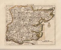
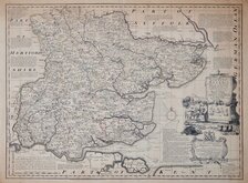
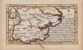
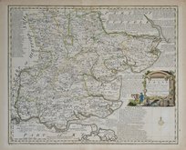
ESSEX.
Pubd. by Archd Fullarton & Co. Glagow.
Engd. by Gray & Son.
Steel engraving by Gray & Son first published in Bell's New and Comprehensive Gazetteer in 1833.
The text for the gazetteer was largely copied from Lewis' Topographical Dictionary of 1831 and in 1839 Lewis obtained an injunction against Bell for plagiarism and the work was withdrawn. Archibald Fullarton, the publisher of Bell's Gazetteer republished the maps with new text in The Parliamentary Gazetteer from 1840 until 1849. Most of the maps were also copied from those in an earlier topographical dictionary, the maps by Sidney Hall prepared for John Gorton's Topographical Dictionary of Great Britain and Ireland published in 1831 as a rival to Lewis' work.
Robert Gray (1771?-1848) Scottish engraver, lithographer and copperplate printer trading from Glasgow as "Gray & Todd" 1804-1856 and as "Gray & Son" 1825-1848, initially with his son John, and later with his son James, who continued the business after Robert Gray's death until at least 1856.
This example, with the indication of the proposed Northern & Eastern and Eastern Counties Railways, is from an edition of The Parliamentary Gazetteer published between 1840 and 1844.
Fine hand colour.
Quick Links

Essex Prints

Road Maps
×