
Road Maps
Essex Maps
( Page 1 of 5 )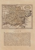
John Seller 1694 [1784]
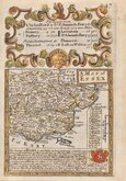
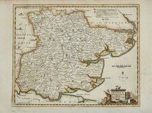
Emanuel Bowen 1720
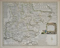
Warburton Bland & Smyth 1726
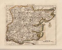
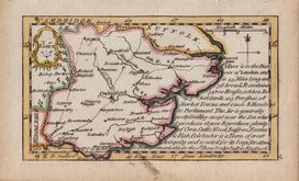
Thomas Read 1746 [1769]
Thomas Kitchin 1748 [1786]
Emanuel Bowen 1749
John Gibson 1759
Emanuel Bowen 1763


28x22 cm
COLOUR PRINTED LITHOGRAPH
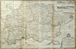
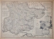
ESSEX
F.S.Weller, F.R.G.S.
WILLIAM MACKENZIE, LONDON, EDINBURGH & GLASGOW
Lithograph printed map from an engraving by Francis Sidney Weller (son of mapmaker Edward Weller) published by William Mackenzie in The Comprehensive Gazetteer of England and Wales issued in parts from c.1891-1895. The plate from which the lithograph was taken was never used for direct intaglio printing. The map is based on the New Series One Inch Ordnance Survey and has been overprinted in colours showing the county divided into the administrative units of Saffron Walden, Epping, Maldon, Harwich, Chelmsford, Walthamstow, Romford, & South Eastern.
Small red tick in right margin. Closed tearr top margin. Short splits at centrefold top and bottom reinforced with archival tape.
Quick Links


Hertfordshire Maps
Essex Prints
×