
Essex Prints
Essex Maps
( Page 1 of 5 )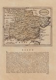
John Seller 1694 [1784]
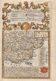
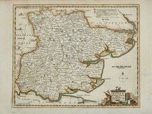
Emanuel Bowen 1720
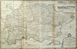
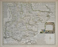
Warburton Bland & Smyth 1726
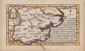
Thomas Read 1746 [1769]
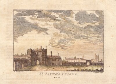
Thomas Kitchin 1748 [1786]
Emanuel Bowen 1749
John Gibson 1759
Emanuel Bowen 1763


35x27 cm
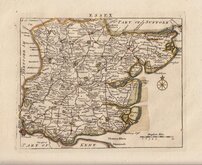
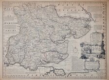
PROPOSED DIVISIONS FOR THE REFORM BILL
ESSEX.
Robt. K. Dawson Lieut. R.E.
J.Netherclift Lithog.
Robert Kearsley Dawson (1798-1861) was the son of Robert Dawson (1771-1860), a draughtsman with the Corps of Royal Military Surveyors and Draughtsmen, retiring in 1836. Robert Kearsley Dawson worked as a draughtsman for the Ordnance Survey on Scottish and Irish surveys under Major Colby before commencing the task of preparing a full set of county plates and borough plans of England and Wales, mostly based on new surveys. In 1832 Parliament introduced The Reform Bill reviewing the boundaries of the boroughs affected by the changes in the electoral process. This series of maps and plans, prepared by Dawson, were produced as the official record of those changes. They were printed from a lithographic stone and coloured by hand. There were a number of editions in 1831 & 1832 recording the development of the proposals for the parliamentary divisions.
This map of Essex has no printed border but the printed area measures approximately 33x23cm. and with a large blank area on the right, a page size of 63x35cm. There is also a page of the accompanying text from the report listing the proposed divisions with populations.
Good condition. Vertical folds as isssued.
Quick Links

Road Maps

Hertfordshire Maps
×