
Road Maps
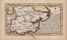
Essex Maps
( Page 1 of 5 )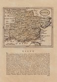
John Seller 1694 [1784]
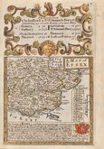
Emanuel Bowen 1720
Warburton Bland & Smyth 1726
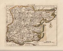
Thomas Read 1746 [1769]
Thomas Kitchin 1748 [1786]
Emanuel Bowen 1749
John Gibson 1759
Emanuel Bowen 1763


43x31 cm
HAND COLOURED LITHOGRAPH CASSELL EDITION
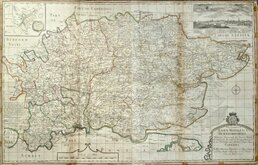
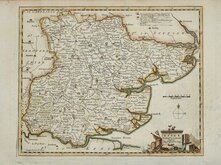
ESSEX
BY B.R.DAVIES. FROM THE ORDNANCE SURVEY.
MAGUIRE, MACDONALD & MACGREGOR’S, STEAM LITHO. MACHINES. LONDON | LONDON, PUBLISHED BY CASSELL, PETTER & GALPIN, LA BELLE SAUVAGE YARD, LUDGATE HILL, E.C.
Commencing publication in 1859, this series of maps were printed by lithographic transfer from an engraved plate for The Weekly Dispatch Newspaper. The maps were also published as loose sheets and, when the series was complete, in The Dispatch Atlas in 1863. The publishers Cassell Petter and Galpin acquired the plates publishing them as loose sheets from 1864 and in Cassell's Illustrated family paper and Cassell's British Atlas in 1867. By 1869, the firm of G. W. Bacon had acquired the plates and published them in a number of titles for over forty years.
This map of Essex includes statistical, topographical and parliamentary information transferred from type and is from the Cassell issue published from 1864 to 1867.
A few archival tape repairs verso to chips and closed tears at paper edges not affecting the printed area. Closed tear bottom centrefold reaching printed border. Fine hand colour.
Quick Links


Hertfordshire Maps
Essex Prints
×