
Hampshire Maps
Dorset Maps
( Page 1 of 3 )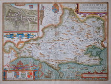
John Speed 1610 [1676]
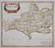
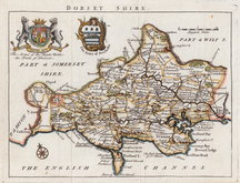
Robert Morden 1695
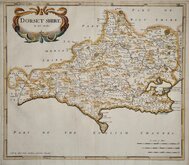
Robert Morden 1695
Owen & Bowen 1720
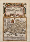
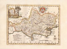
Robert Walker 1748
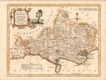
Thomas Kitchin 1750 [1786]
Thomas Kitchin 1764
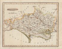
Benjamin Baker 1791


24x19 cm
EARLY STEEL ENGRAVING
DORSETSHIRE.
Engd. by Gray & Son.
Pubd. by Archd. Fullarton & Co. Glasgow.
Steel engraving by Gray & Son first published in Bell's New and Comprehensive Gazetteer in 1833. The text for the gazetteer was largely copied from Lewis' Topographical Dictionary of 1831 and in 1839 Lewis obtained an injunction against Bell for plagiarism and the work was withdrawn. Archibald Fullarton, the publisher of Bell's Gazetteer republished the maps with new text in The Parliamentary Gazetteer from 1840 until 1849. Most of the maps were also copied from those in an earlier topographical dictionary, the maps by Sidney Hall prepared for John Gorton's Topographical Dictionary of Great Britain and Ireland published in 1831 as a rival to Lewis' work.
Robert Gray (1771?-1848), Scottish engraver, lithographer and copperplate printer, trading from Glasgow as "Gray & Todd" between 1804 and 1806 and as "Gray & Son" from 1825 to 1848, initially with his son John, and later with his son James who continued the business after Robert Gray's death until at least 1856.
Some creasing upper left. Neat hand colour. First state.
Quick Links


Wiltshire Maps

Somerset Maps
×