
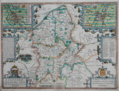
Staffordshire Maps
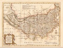
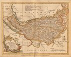
Cheshire Maps
( Page 1 of 3 )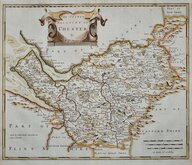
Robert Morden 1695
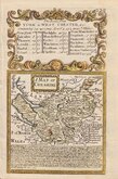
Emanuel Bowen 1720
Thomas Kitchin 1763
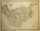
Ellis Joseph 1773
Benjamin Baker 1791
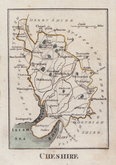
Robert Butters 1803
Smith, Charles. 1804
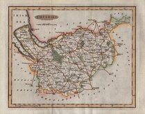
Cary, John 1805


26x19 cm
Decorative steel engraving in fine hand colour.
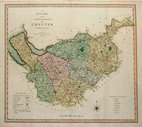
Engraved by W. Schmollinger, this series of maps were produced for publication in Moule's English Counties, the engraving work shared between Schmollinger, John Dower and James Bingley. The work was first issued in parts from 1830 and first appearing complete in atlas form in 1836, published by George Virtue. Virtue later used the plates for publication in Barclay's Universal English Dictionary from 1842 until 1852. The plates were continuously amended to reflect the changes to the country affected by the rapidly growing railway network with most county plates known in over eight or more different 'states'.
The maps are commonly known as 'Moule's' as they first appeared in the works above. Thomas Moule (1784-1851) was a writer on heraldry and antiquities, a bookseller, and, finally, Inspector of blind letters for the Post Office and Chamber-Keeper of the Lord Chamberlain's Department.
Includes vignettes of Chester Cathedral and Eton Hall.
Quick Links
Lancashire Maps

Road Maps
×