
Northamptonshire Maps
Leicestershire Maps
( Page 1 of 3 )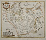
Robert Morden 1695 [1753]
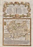
Emanuel Bowen 1720
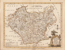
Joseph Ellis 1765 [1773]
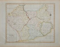
John Haywood 1787 [1791]
John Cary 1787 [1793]
John Cary 1789 [1805]
Robert Butters 1803
John Cary 1808 [1809]


42x36 cm
FIRST MAP OF THE COUNTY TO SHOW LONGITUDE BASED ON LONDON.
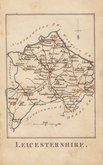
LEICESTER SHIRE
by Rob.t Morden
Sold by { Abel Swale Awnsham & Iohn Churchil.
Copper engraving produced by Robert Morden for publication in Edmund Gibson's translation of William Camden's Britannia first published by Abel Swalle and Awnsham & John Churchill in 1695. This is the first series of maps to mark longitude in minutes of time (top border) as well as in degrees (bottom border). For most counties longitude is based on the meridian of St. Paul's, London.
The work was republished in 1722, 1730, 1753 and, finally in 1772. The plate was updated for the 1722 edition mostly with changes to place name spellings and was reworked for the 1753 edition due to wear on the plate.
Some wrinkling to paper at the top edge and a minor flaw in the paper at Normanton, upper right in the county, but a good clean example from the 1753 edition. Neat later hand colour.
Quick Links


Warwickshire Maps

Staffordshire Maps
×