
Staffordshire Maps
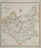
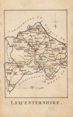
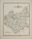
Leicestershire Maps
( Page 1 of 3 )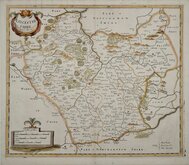
Robert Morden 1695 [1753]
Emanuel Bowen 1720
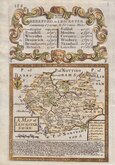
Joseph Ellis 1765 [1773]
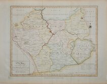
John Haywood 1787 [1791]
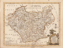
John Cary 1787 [1793]
John Cary 1789 [1805]
Robert Butters 1803
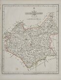
John Cary 1808 [1809]


43x48cm cm
"CARY STOCKDALE"
A MAP OF LEICESTERSHIRE from the Best AUTHORITIES
Published by John Stockdale
Piccadilly 26th. March 1805.
Engrav'd by J. Cary.
E. Noble delint.
Copper engraving by John Cary. The maps were first issued in parts by T. Payne & Son, and G.G.J. & J. Robinson for Richard Gough's translation of William Camden's Britannia, the completed work being published in 1789. Following the death of Payne, the Robinson family sold the plates and publication rights to John Stockdale. Richard Gough was reportedly annoyed with the new arrangements and refused to work on the new edition and Stockdale completed the editorial work himself, expanding the work to four folio volumes and publishing them in 1806. Stockdale also used the plates in his New British Atlas from 1805 to 1809.
This example of the county of Leicestershire is from the Stockdale edition of 1805.
Small side margins with bottom right edge just clipping the printed margin both re-margined to help with framing. Folds as issued. Some light offsetting. Fine hand colour.
Quick Links


Warwickshire Maps

Northamptonshire Maps
×