
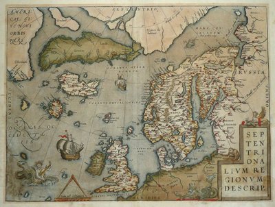
Atlantic & Poles
World Maps and Charts
( Page 2 of 4 )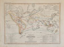
Petermann Birds and Reptiles 1854
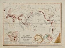
Petermann Volcanoes Earthquakes 1854
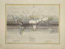
Petermann Rainfall 1854
John Tallis 1851
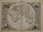
John Tallis 1851
John Tallis 1851
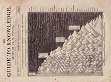
Comparative Chart Rivers and Mountains 1832
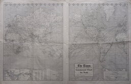
World Shipping Routes 1912


60x40 cm
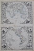
THE WORLD IN HEMISPHERES
BY KEITH JOHNSTONE F.R.S.E.
Engraved & Printed | by W.& A.K. Johnston, Edinburgh.
William Blackwood & Sons, Edinburgh & London.
Large lithographic printed map published in The Royal Atlas Of Modern Geography Exhibiting, in a series of entirely original and authentic maps, the present condition of geographical discovery and research in the several countries, empires, and states of the World by Alexander Keith Johnston geographer to the Queen for Scotland...William Blackwood & Sons Edinburgh and London MDCCCLXIX.
Overprinted in blue indicating rivers, lakes and sea names with hand colouring indicating countries.
A finely engraved map from the first edition of Johnston's atlas.
Short split at bottom centrefold affecting the Blackwood imprint, some browning to paper edges, a couple of spots above the Keith Johnston signature between the hemispheres and light off-setting from the original hand colour. It remains an attractive and presentable map.
Quick Links
Celestial

Historical Maps
×