
Herefordshire Maps
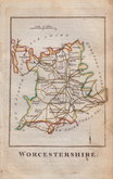
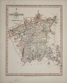
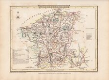
Worcestershire Maps
( Page 2 of 3 )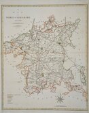
John Cary 1789 [1805]
Robert Butters 1803
John Cary 1808 [1809]
George Cole 1810
Samuel Neele 1819
Sidney Hall 1820
John Cary 1822
Roger Creighton 1831 [c.1842]


41x50` cm
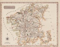
"STOCKDALE CARY"
A MAP of WORCESTERSHIRE, from the best AUTHORITIES.
Published by John Stockdale Piccadilly 26th March 1805.
Engraved by J. Cary.
Copper engraving by John Cary (1755-1835). The maps were first issued in parts by T. Payne & Son, and G.G.J. & J. Robinson for Richard Gough's translation of William Camden's Britannia, the completed work being published in 1789. Following the death of Payne, the Robinson family sold the plates and publication rights to John Stockdale. Richard Gough was reportedly annoyed with the new arrangements and refused to work on the new edition and Stockdale completed the editorial work himself, expanding the work to four folio volumes and publishing them in 1806. Stockdale also used the plates in his New British Atlas from 1805 to 1809.
A good clean hand coloured example from the Stockdale edition of 1805. Dated watermark of 1804.
Quick Links


Staffordshire Maps

Warwickshire Maps
×