
Warwickshire Maps
Worcestershire Maps
( Page 1 of 3 )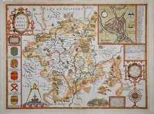
John Speed 1610 [1676]
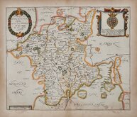
Richard Blome 1673
Robert Morden 1695
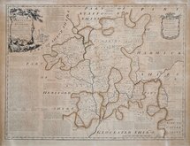
Emanuel Bowen 1720
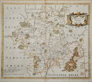
Emanuel Bowen 1756
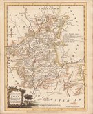
Thomas Kitchin 1764
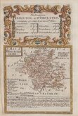
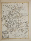
William Fowler 1765
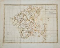
John Haywood 1789


10x15 cm
CARY'S MINIATURE SERIES, REVISD=ED EDITION.
WORCESTERSHIRE
London. Published by G.&J.Cary, N.o 86 S.t James's Str.
A re-engraved and revised version of of the map issued by John Cary in 1806 which in turn, was a re-engraved version of his 1789 map. All were issued under the title of Cary's Traveller's Companion, a highly successful work necessitating the re-engraving of worn plates to continue publication. The map was later published by Crutchley in his Railroad Companion of 1862 printed by lithographic transfer.
Intaglio printed version of the map in original hand colour published 1822-28.
Impression on the paper from adajcent folded map of Yorkshire in the publication. Good margins.
Quick Links


Herefordshire Maps

Staffordshire Maps
×