
Hampshire Maps
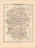
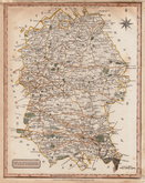
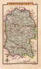
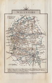
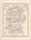
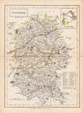
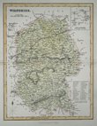
Wiltshire Maps
( Page 2 of 3 )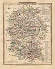
George Cole 1810
George Cole 1810
Samuel John Neele 1818 [1819]
Sidney Hall 1820
John Cary 1822
Roger Creighton 1831
Selina Hall 1833 [1852]
Gray & Son 1833 [c.1840]


17x22 cm
"HOGG" EDITION
WILTSHIRE Drawn from the best Authorities and Regulated by Astronl.Observations. By T.Kitchin Geog.r
Arms of Sallisbury.
The Wiltshire map was first published in The London Magazine by R Baldwin in September 1751, with the the complete series of county maps published in England Displayed by S Bladon etc., in 1769 and under various titles including Boswell's Antiquities by Alexander Hogg from 1786 to 1798.
This good clean example on good paper is from a publication by Alexander Hogg in very good later hand colour.
Quick Links


Berkshire Maps

Gloucestershire Maps
×