
Hampshire Maps
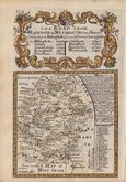
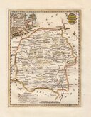
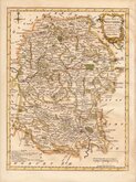
Wiltshire Maps
( Page 1 of 3 )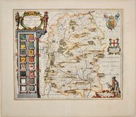
Jan Blaeu 1645
Owen & Bowen 1720
Thomas Kitchin 1751 [c.1786]
Thomas Kitchin 1763
Thomas Bowen 1767 [c.1770]
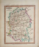
Benjamin Baker 1795 [c.1807]
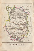
Robert Butters 1803
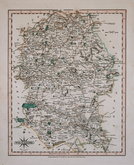
John Cary 1808 [1809]


19x25 cm
EARLY STEEL ENGRAVING
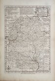
WILTSHIRE.
Pub.d by Arch.d Fullarton & C.o Glasgow.
Steel engraving by Gray & Son first published in Bell's New and Comprehensive Gazetteer in 1833. The text for the gazetteer was largely copied from Lewis' Topographical Dictionary of 1831 and in 1839 Lewis obtained an injunction against Bell for plagiarism and the work was withdrawn. Archibald Fullarton, the publisher of Bell's Gazetteer republished the maps with new text in The Parliamentary Gazetteer from 1840 until 1849. Most of the maps were also copied from those in an earlier topographical dictionary, the maps by Sidney Hall prepared for John Gorton's Topographical Dictionary of Great Britain and Ireland published in 1831 as a rival to Lewis' work.
Archival repairs to centrefold on back of map. Later hand colour.
Quick Links


Berkshire Maps

Gloucestershire Maps
×