
Gloucestershire Maps
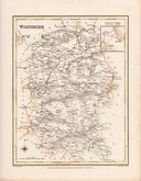
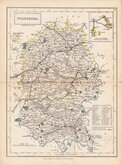
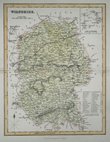
Wiltshire Maps
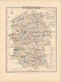
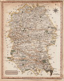
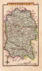
( Page 2 of 3 )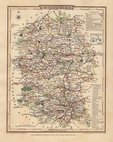
George Cole 1810
George Cole 1810
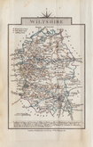
Samuel John Neele 1818 [1819]
Sidney Hall 1820
John Cary 1822
Roger Creighton 1831
Selina Hall 1833 [1852]
Gray & Son 1833 [c.1840]


20x26 cm
DETAILED ENGRAVING. NEAT HAND COLOUR.
WILTSHIRE.
Published by J. Robins & Co. Albion Press, London January 1. 1818. | Neele Sculpt. 352 Strand.
Drawn and engraved by Samuel John Neele, this series were based on John Cary's 'quarto' maps of 1793. The early publication of this series is complex with loose issues and parts issues for many counties from about 1812. The first main publication containing the complete set of county maps was The New British Traveller; or, modern panorama of England and Wales...By James Dugdale... published about 1818 by J & J Cundee. The map appeared in only three further issues under different titles in 1819 and 1820.
This example of the map of Wiltshire has the imprint of J Robins dated 1818 and was published by J Robins & Co.from 1819 to 1820. Re-margined top edge and toning at edges but a very detailed map in good hand colour.
Quick Links


Hampshire Maps

Berkshire Maps
×