
Berkshire Maps
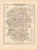
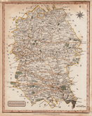
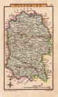
Wiltshire Maps
( Page 2 of 3 )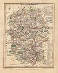
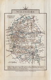
George Cole 1810
George Cole 1810
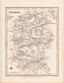
Samuel John Neele 1818 [1819]
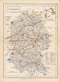
Sidney Hall 1820
John Cary 1822
Roger Creighton 1831
Selina Hall 1833 [1852]
Gray & Son 1833 [c.1840]


18x24 cm
ORIGINAL WASH COLOUR.
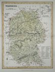
WILTSHIRE
Drawn and engraved by Joshua Archer for publication in Curiosities of Great Britain, England and Wales Delineated…by Thomas Dugdale.
The work was first published by L. Tallis in 1842 and was republished a number of times until 1860. The maps also appeared in The Universal English Dictionary…by the Rev. James Barclay and finally in Tallis's topographical dictionary of England & Wales in 1860.
Archival tape verso over small area of thinned paper at centrefold but still a good example of the map of Wiltshire in original hand colour from the 1846 edition of Dugdale's Curiosities.
Quick Links


Gloucestershire Maps

Hampshire Maps
×