
Hampshire Maps
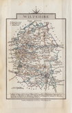
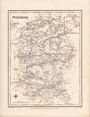
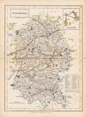
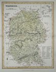
Wiltshire Maps
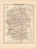
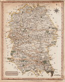
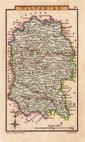
( Page 2 of 3 )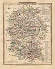
George Cole 1810
George Cole 1810
Samuel John Neele 1818 [1819]
Sidney Hall 1820
John Cary 1822
Roger Creighton 1831
Selina Hall 1833 [1852]
Gray & Son 1833 [c.1840]


8x12 cm
FROM "OWEN & BOWEN" POCKET ROAD BOOK BRITANNIA DEPICTA
A MAP of WILT SHIRE
Map set below the title to the road from London to Weymouth.
Engraved by Emanuel Bowen (1693?-1767) and published in the pocket road book Britannia Depicta by Thomas Bowles from 1720 to 1764. The county maps were based on Robert Morden's small series published in The New Description and State of England... from 1701.
Road map of the second part of the route from Newmarket to Wells-next-the-Sea verso.
Very good in neat later hand colour.
For full description of the road, go to the listing (plate 133) under category: RoadMaps>Owen & Bowen.
Quick Links


Gloucestershire Maps

Berkshire Maps
×