
Yorkshire West Riding
Whole of Yorkshire
( Page 1 of 4 )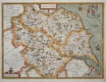
John Speed 1610 [1627]
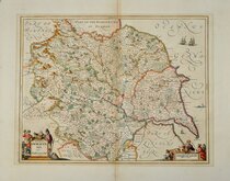
Jan Jansson 1646
Richard Blome 1673
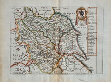
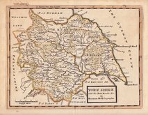
John Seller 1694
John Seller 1694 [c.1784]
Herman Moll 1724 [1753]
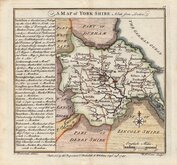
Badeslade, Thomas 1741
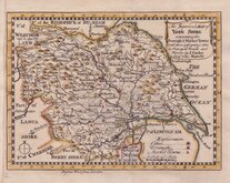
John Cowley 1743


50x40 cm
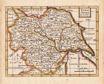
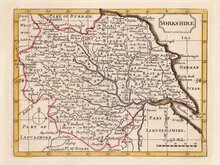
ORIGINALHAND COLOURING DEPICTING THE POOR LAW UNIONS
YORKSHIRE
Drawn by R. Creighton | Engraved by Tho.s Starling.
DRAWN AND ENGRAVED FOR LEWIS' TOPOGRAPHCAL DICTIONARY.
Copperplate engraving by Thomas Starling (1796-1850), drawn by Roger Creighton (1796-1838) for publication in Lewis's Topographical Dictionary from 1831.
Roger Creighton, draughtsman and land surveyor, son of David Creighton and his wife Catherine Lawson, who married at Tynemouth in 1794. He is first recorded as a land surveyor in Wakefield. He drew the 1818 map of Lancaster for Christopher Greenwood and worked on the insets for Cristopher and John Greenwwod’s large scale county maps and moved to London at the same time as the Greenwoods. He married Martha Gosling 16 Jan 1823 at St. George Hanover Square, London.After the collapse of the Greenwood large scale county map project he became the principal draughtsman for the Topographical Dictionary published by Samuel Lewis, He was buried 9 April 1838 at St. Luke Chelsea.
Thomas Starling, draughtsman, engraver, printer, bookseller and publisher, was born 24 Dec 1796, son of Robert Starling and his wife Elizabeth Kearsley, and baptised at St. Mary Islington on 18th January 1797. Thomas had two brothers in similar trades; Parlett Starling, printer, James Kearsley Starling, bookseller, and Matthew James Staring, engraver (mainly topographical views). Thomas was apprenticed (Stationers) in 1811. He married Ellen Smart at Mackworth, Derbyshire, 2nd November 1821. Declared bankrupt in 1824, he featured in a trial at The Old Bailey in 1828 when a canvasser, employed selling his plans of Islington, was prosecuted for embezzling the subscriptions. He was elected Fellow of the Royal Geographical Society on 23rd December 1833. Briefly imprisoned for debt in 1837, the 1841 Census describes him as an engraver living in Islington with his wife Ellen, schoolmistress, and three children. He died at Rochford, Essex, 15th June 1850.
This map of Yorkshire published between 1840 and 1845, includes the addition of the poor law unions and has been hand coloured according to these new administrative boundaries.
Folds as issued and repair to short closed tear at horizontal fold left margin and bottom centre, otherwise a good example in original outline hand colour.
Quick Links


Yorkshire East Riding

Yorkshire North Riding
×