
Yorkshire North Riding
Whole of Yorkshire
( Page 1 of 4 )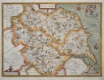
John Speed 1610 [1627]
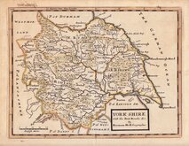
Jan Jansson 1646
Richard Blome 1673
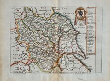
John Seller 1694
John Seller 1694 [c.1784]
Herman Moll 1724 [1753]
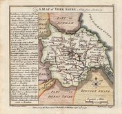
Badeslade, Thomas 1741
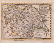
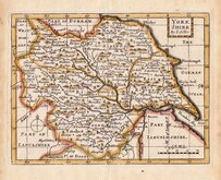
John Cowley 1743


28x21 cm
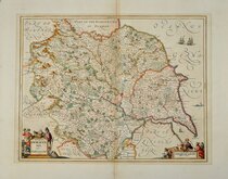
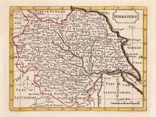
BLOME'S LARGER SERIES. COPIED FROM SPEED.
A MAPP of YORKSHIRE With its Divisions and Hundreds London printed for Ric: Blome 1670
To ye R.t Hon.ble Charles L.d Fairfax Vis.ct Emula in ye Kingdome of Ireland &. This Mapp is Humbly Dedicated by Ric Blome.
Produced and published by Richard Blome (1635-1705) bookseller, mapseller and publisher, printer to King William III and cosmographer to Queen Anne, in Britannia: or, A Geographical Description of the Kingdoms of England, Scotalnd and Ireland...London, Printed by Tho. Rycroft for the Undertaker, Richard Blome. 1673.
This series of maps were produced quickly following an announcement in the press by John Ogilby of his intention to produce a new work of county maps, road maps and town plans entitled Britannia. Blomes maps are crudely engraved, typical of journeyman work, and mostly copied from those of John Speed. The printing, however was of the highest standard, being carried out by Thomas Roycroft, printer to King Charles II. Richard Blome shamelessly used the same title announced by John Ogilby for his work, commencing publication in 1673.
The edition was probably on sale for four years. There was a re-issue of 1677 made up by John Wright from remaindered sheets.
Light browning at lower centrefold. Good example in neat hand colour.
Ref. Whitaker Printed Maps of Yorkshire [120]
Quick Links


Yorkshire East Riding

Yorkshire West Riding
×