
Yorkshire East Riding
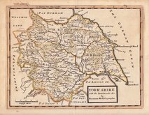
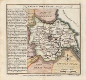
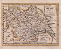
Whole of Yorkshire
( Page 1 of 4 )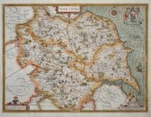
John Speed 1610 [1627]
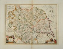
Jan Jansson 1646
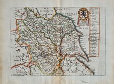
Richard Blome 1673
John Seller 1694
John Seller 1694 [c.1784]
Herman Moll 1724 [1753]
Badeslade, Thomas 1741
John Cowley 1743


9x13 cm
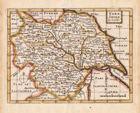
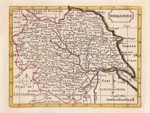
RARE "UPSIDE-DOWN" SERIES.
YORKSHIRE.
The engraver or engravers of this series of maps are unknown and the maps are known by the first publisher, Robert Butters, a Fleet Street printer, who issued them in An Atlas of England... in 1803. They are also referred to as the "upside-down series" as the England map and many of the county maps are engraved with North to the bottom of the page. In fact, the county maps are variously orientated with North to the top, left, right or bottom of the page. The work was possibly intended for school use and the odd orientation of the maps may have been done to appeal to young minds. This represented Robert Butters' only serious venture into cartography but unlike the huge success of John Cary's publication The Traveller's Companion, on which these maps were based, Butter's publication was limited to this single issue. John Hatchard acquired the plates later the same year issuing them in a two-volume work The Picture of England 1803, and 1804. The publications were small and only a single copy of the 1803 edition has been found.
This Yorkshire map is oriented with North to the left with the compass point incorrectly showing North to the bottom.
Fine example in original hand colour of a rare map.
Ref. Whitaker Printed Maps of Yorkshire [291]
Quick Links


Yorkshire North Riding

Yorkshire West Riding
×