
Yorkshire West Riding
Whole of Yorkshire
( Page 1 of 4 )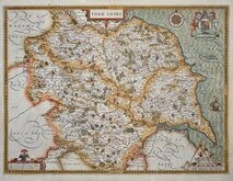
John Speed 1610 [1627]
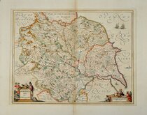
Jan Jansson 1646
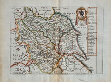
Richard Blome 1673
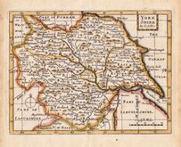
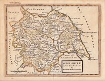
John Seller 1694
John Seller 1694 [c.1784]
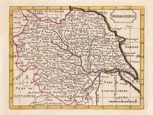
Herman Moll 1724 [1753]
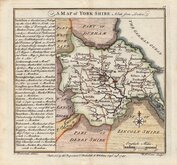
Badeslade, Thomas 1741
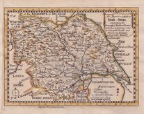
John Cowley 1743


164x122 cm
LARGE TWO SHEET FOLDING MAP. FIRST EDITION.
This Map of YORKSHIRE, is most respectfully dedicated TO THE Nobility, Clergy, Gentry, Landowners, AND MANUFACTURERS OF THE COUNTY, By the Proprietor, William Colling Hobson. 1843.
ENGRAVED BY J & C WALKER.
Published by William Colling Hobson, York, July 1843.
Large two sheet map, segmented and pasted on linen, each sheet (82x122cm) segmented in 16 sections and pasted to the endpapers of brown cloth board covers.
Brown cloth, embossed and gilt decoration to front board and with brass clasp, are bumped and worn and lacks spine so the boards (and the folding map sheets) are separate. The map has some occasional light browning and marking but otherwise undamaged and the fine original hand colouring is bright.
The map was re-issued four times until 1847, this example, published by Hobson in July 1843 is the first edition.
Whitaker Printed Maps of Yorkshire ref. 465
Quick Links


Yorkshire North Riding

Yorkshire East Riding
×