
Yorkshire West Riding
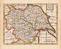
Whole of Yorkshire
( Page 1 of 4 )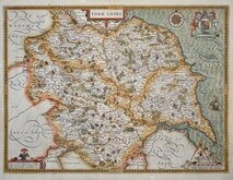
John Speed 1610 [1627]
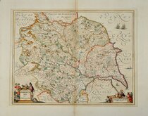
Jan Jansson 1646
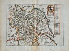
Richard Blome 1673
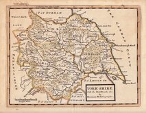
John Seller 1694
John Seller 1694 [c.1784]
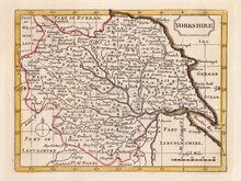
Herman Moll 1724 [1753]
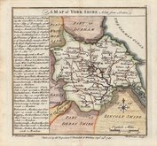
Badeslade, Thomas 1741
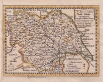
John Cowley 1743


36x31 cm
FROM CARY'S TRAVELLER'S COMPANION
The Turnpike Roads of YORKSHIRE By JOHN CARY, Engraver.
London. Published by G.& J.Cary, No. 86 St. James's Str.
This series of maps were first issued in Cary's Travellers Companion, London, 1790 by John Cary (1755-1835), the foremost mapmaker of his time. A very popular work, the plates were re-engraved for editions from 1806 and again for editions from 1822. This example of the map of Yorkshire is from this last version published from 1822 to 1835 and has the imprint of George & John Cary, both sons of John Cary who took over their father's business after the Strand premises burned down in 1820. George Cary (1787-1859) set up business with a new premises in St. James Street as senior partner with his younger brother John (1791-1852).
Unlike the other county maps in the series which were printed on a single page, the map of Yorkshire was engraved on a larger plate and folded several times into the pocket volume and as a consequence is often found with damage. This example has several tears with old repairs verso using linen and postage stamp sheet borders.
Original hand colour.
Ref. Whitaker Printed Maps of Yorkshire [359]
Quick Links


Yorkshire East Riding

Yorkshire North Riding
×